Cloud height (radar-measured) | Web Scraping Tool | ScrapeStorm
Abstract:Cloud height (radar-measured) refers to cloud top height and cloud base height information derived from electromagnetic wave pulses emitted by meteorological radar (such as weather radar or cloud radar) by receiving backscatter signals from hydrometeors (cloud droplets, raindrops, ice crystals, etc.) inside clouds. ScrapeStormFree Download
ScrapeStorm is a powerful, no-programming, easy-to-use artificial intelligence web scraping tool.
Introduction
Cloud height (radar-measured) refers to cloud top height and cloud base height information derived from electromagnetic wave pulses emitted by meteorological radar (such as weather radar or cloud radar) by receiving backscatter signals from hydrometeors (cloud droplets, raindrops, ice crystals, etc.) inside clouds. Unlike laser ceilometers, radar waves can penetrate thick cloud layers and precipitation areas, enabling continuous observation of cloud vertical structure even under adverse weather conditions. Radar-measured cloud height typically includes both cloud top height and cloud base height, serving as an important parameter for severe convection monitoring, precipitation estimation, and aviation weather support.
Applicable Scene
Suitable for scenarios requiring penetrating observation capabilities, especially when optical equipment cannot be used due to precipitating cloud layers, multi-layer cloud structures, or dense fog conditions. Typical applications include: severe convection weather monitoring (e.g., thunderstorms, hail, tornadoes), aviation meteorological support (providing decision-making basis for aircraft to avoid thunderstorm areas), weather modification operations (e.g., determining locations for seeding agents inside clouds), analysis of cloud radiative effects in climate research, and precipitation estimation and flood warning in hydrometeorology.
Pros: Strong penetrating capability, unaffected by cloud thickness, precipitation, or fog, enabling continuous 24/7 operation; can simultaneously obtain cloud top height, cloud base height, echo intensity, and vertical structure information, supporting 3D cloud analysis; suitable for wide-area scanning with detection range far exceeding that of ground-based optical equipment.
Cons: Detection blind zones exist at close range and low altitudes, making it difficult to capture low clouds or shallow thin clouds; retrieval algorithms depend on hydrometeor concentration, and thin clouds or dry convective clouds may produce echoes too weak to detect; high equipment cost and complex deployment, typically existing as fixed stations or mobile radar vehicles; vertical resolution is relatively lower than that of laser ceilometers.
Legend
1.Cloud height.

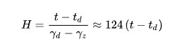
2. Cloud height formula.
Related Article
Reference Link
https://www.sciencedirect.com/topics/earth-and-planetary-sciences/cloud-height-indicator